JRC Global Forest Cover 2020
Licence verifiedWhether this land was forest at the cut-off, and of what type
EC JRC — Bourgoin et al., GFC2020
Free reuse; attribution requested
EUDR satellite evidence
Bring a production boundary and the commodity grown there. Clearlane records what the FAO / Open Foris Whisp method returned, which risk column your declared goods made relevant, and the rule behind the outcome.
This is recorded satellite evidence for one EUDR criterion - not a standalone compliance certificate.
Start with the production boundary and the commodity declared for that land.
Whisp returns source measurements, indicator answers and commodity risk columns.
Download the dated chain from provider column to recorded outcome and rule clause.
The method
Clearlane sends geometry to FAO / Open Foris Whisp. The method operates through Google Earth Engine and draws on a catalogue of 9 published Earth-observation dataset families. Clearlane does not invent a deforestation score: it stores the returned columns and applies the cited rule to the one commodity question that matters for this plot.
A plot boundary and its declared commodity enter the FAO and Open Foris Whisp method. The method draws on a catalogue of nine published dataset families. Clearlane reads the one risk column relevant to the declared commodity and records the answer, any required premise and the cited rule clause.
The catalogue is not a nine-way vote. The evidence report states which family columns were present in the stored result; it does not claim visibility into every upstream dataset execution.
The legal question
It asks whether this land was deforested after 31 December 2020. That date comes from Regulation (EU) 2023/1115, Art. 2(13). Change before the cut-off remains visible in the record, but it is not silently treated as post-cut-off change.
The fictional sample report carries eight annual series with a combined recorded span of 2000-2026. Each source keeps its own observed span, and a missing year stays a gap rather than becoming a zero.
The source catalogue
These are the nine source families recorded in Clearlane's cited Whisp inventory. They answer different questions and may return different columns by plot. They are not nine independent checks, and they are never tallied into a confidence score.
Licence status is deliberately split. Clearlane's source record verifies 3 of 9; the other 6 are attributed, but their licence terms are recorded as unestablished.
Whether this land was forest at the cut-off, and of what type
EC JRC — Bourgoin et al., GFC2020
Free reuse; attribution requested
Tree cover at the cut-off, and annual tree-cover loss from 2001 onwards
UMD & Google — Hansen et al. 2013
CC-BY-4.0 — attribution required
Annual deforestation and degradation in the moist tropics, 1990 onwards
EC JRC — Vancutsem et al. 2021
Licence not established in our capture — attributed regardless
Dated Sentinel-1 radar alerts, which see through cloud
Wageningen University — Reiche et al. 2021
Licence not established in our capture — attributed regardless
Dated optical alerts; the Sentinel-2 series covers the Amazon basin only
UMD — Hansen et al. 2016; Pickens et al. 2020
Licence not established in our capture — attributed regardless
Land cover at 10 m for two epochs, 2020 and 2021
European Space Agency — Zanaga et al.
CC-BY-4.0 — attribution required
Modelled probability a mapped commodity crop is present, 2020 and 2024
Forest Data Partnership, 2025
Licence not established in our capture — attributed regardless
Annual burned area; fire is not by itself deforestation
NASA MCD64A1.061; ESA Climate Change Initiative
Licence not established in our capture — attributed regardless
National annual deforestation series where one exists
MapBiomas, INPE PRODES/DETER, IDEAM, BNETD
Licence not established in our capture — attributed regardless
Current request condition: The provider returns these only when a country code is supplied with the submission, and Clearlane does not send one.
The relevant question
Whisp currently returns three commodity-specific risk columns. They are parallel questions, not three gates one plot must all pass. Clearlane selects the column mapped to the commodity declared for that plot and records which one it read.
The mapping is intentionally conservative. A missing, unreadable or unsupported selected value never becomes Clear. That can over-flag instead of falsely clearing on absent evidence.
Risk_PCropRisk_ACropRisk_TimberOne declared commodity -> one relevant column -> one recorded reading.
The derivation
The evidence PDF names the column read, repeats the provider's answer, shows any premise the selected rule branch required, and identifies which published clause the stored values met.
A cited deterministic engine decides the recorded outcome. AI does not inspect the satellites or produce the compliance answer; it may only help explain information already recorded.
Real renderer output
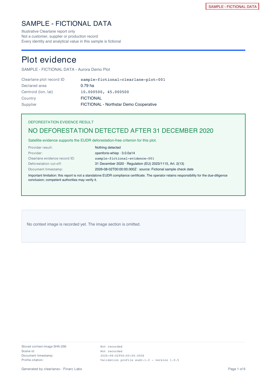
This is the same PDF renderer the product uses, driven by a fully synthetic plot fixture. Every page is headed SAMPLE - FICTIONAL DATA; it is not a customer, supplier or production record.
Inside this exact six-page sample
The fictional sample records No deforestation detected after 31 December 2020. The page-one limitation makes clear that this supports the EUDR deforestation-free criterion for this plot; it is not a standalone compliance certificate.
 Open the full six-page PDF
 The honest boundary
Earth Engine datasets roll forward. Clearlane records the evidence as it stood on the check date; it does not promise that a later re-check must produce the same underlying values.